


Navigation
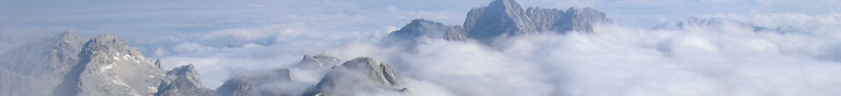
If you are going to venture into the hills, you will need a map of the area which covers your walk, a compass and, of course, an understanding of how to use them. Navigation is a key skill for walkers and mountaineers. Testing your skills can be great fun, and it is advisable to learn and practice the basics early on. Advanced skills will enable a walker to navigate confidently through the toughest terrain and mountain-weather conditions.
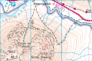
For most areas of Scotland, the maps you are most likely to use are the Ordnance Survey Landranger 1:50000 or Explorer 1:25000 scale maps (or their online equivalents); there are a number of other maps on the market, for specific hill areas, like Harveys. Most current walking books tell you the sheet number of the OS map(s) you will need for your planned route.
Navigation follows a set of basic rules and concepts, which you can build on to become more skilled; but it is a fact that many accidents are caused by basic errors in route finding. It does takes practice to become familiar with the rules and to relate the map to the terrain in front of you.
Modern gadgets: a Global Positioning System - or GPS - can be a helpful additional tool on the hill; however it is not a substitute for good compass and map reading skills. You will not be able to effectively use a GPS if you cannot interpret a map and navigate with a compass. There can also be problems using a GPS if there is no line-of-sight due to the nature of the terrain; or when the batteries run down!
The Mountaineering Scotland has identified 12 important basics, which should, once mastered, allow you to navigate safely in the hills:
http://www.mountaineering-scotland.org.uk/safety/nav_dozen.html
Paisley Hillwalking Club runs occasional navigation activities where beginners can spend a day or a weekend learning to how to read a map and how to use a map and compass out on the hills.
Orienteering is also a really great way of learning the fundamental skills, while exercising body as well as mind. This activity is about navigating in sequence between control points marked on an orienteering map, deciding the best route to complete the course in the quickest time. You can visit http://www.scottish-orienteering.org/ for more information on events, clubs and maps (orienteering uses larger scale maps such as 1:5000 but the basics are the same).
We recommend you get hold of a specialist navigation book from the library or take part in a course to get you started. If there is not a Club weekend course coming up, there are some other suggestions below. Or simply book onto one of our Sunday walk trips and get some initial advice there!
Navigation Publications
The British Mountaineering Council publish some good, inexpensive booklets, including Navigation; and Safety on Mountains:
http://www.bmcshop.co.uk/index.php?cPath=313_315
Publications with wider mountain skills, including good sections on navigation:
The Mountain Skills Training Handbook – Pete Hill and Stuart Johnston
Mountaincraft and Leadership – Eric Langmuir
Courses:
http://www.mountaineering-scotland.org.uk/safety/nav_course.html
http://www.glenmorelodge.org.uk/mountaineering-courses/cat-19-summer-walking-navigation/
Other Links:
http://www.mountaineering-scotland.org.uk/safety/emergency.html